Creating a Coordinate System from Scratch
- Open Map Projection Settings Main: Project > Settings > Set Map Projection
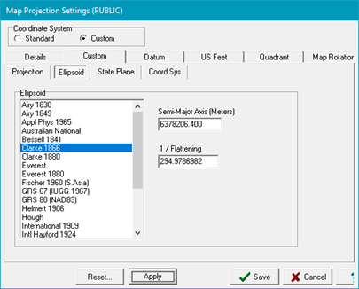
- Select a project reference datum from the Datum tab and select the Custom Coordinate System.
- On the Elipsoid tab, select the desired ellipsoid. Make sure the projection and associated ellipsoid match the chosen Reference Datum.
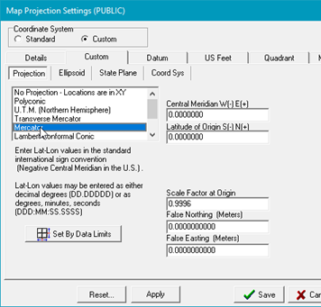
- On the Projection tab, select the specific projection type and projection parameters such as central meridian. Petra will accept LatLon values in either decimal degrees or as degrees:minutes:seconds.
The parameters listed will depend on the specific projection type. As an example, only the UTM projection lists UTM zones.
- Click,Save to enact the changes.
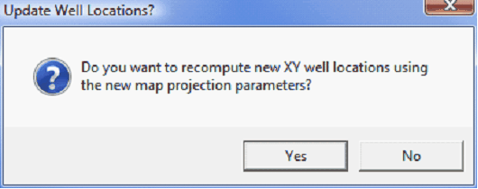
For new projects this will simply set the project's map projection. For existing projects, saving a different coordinate system means that the XYs of all the data will need to change as well. Make sure to
- Select Yes when asked to recompute XY well locations using the new map projection.